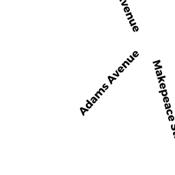
2 ADAMS AV
Owner Information
MOORE, ROBERT W. & TERESA M.
2 ADAMS AVE
SAUGUS, MA 01906


Property Details
2 ADAMS AV is classified as a Two-Family Residential (Old style).
The primary structure on this property was built in 1865. There are 2,641ft2 of built area within this property. There is 2,641ft2 of residential/living space within this property. This property is listed as having 10 rooms. There are 2 units within this property.
2 ADAMS AV is valued at $471,700. The land is valued at $194,800 and the structures are valued at $276,900.
The most recent deed for 2 ADAMS AV is recorded at the local registrar in Book 6392, Page 783. 2 ADAMS AV was last sold on Thursday, March 17, 1994 for $110,000.
Assessment data from fiscal year 2022.
Flood Data
According to the FEMA National Flood Hazard Layer, this property does not appear to be in a flood zone. It may also be in an area not yet reviewed. Nonetheless, confirm this information prior to taking any action.
To view the flood hazards around this property, create a FEMA "Firmette" Map of the area around 2 ADAMS AV.
Broadband Internet Providers
| Provider | Type | Bandwidth (mbps) | |
|---|---|---|---|
| GCI Communication Corp. | Satellite | 0 | 0 |
| HughesNet | Satellite | 25 | 3 |
| VSAT Systems, LLC. | Satellite | 2 | 1 |
| Comcast | Cable | 1000 | 35 |
| Verizon New England Inc. | DSL | 15 | 1 |
| Viasat Inc | Satellite | 100 | 3 |
Broadband service provider data from December 2020.